Tuesday 31 July 2018

Junk shopper's paradise

Brandon is a small town full of flint buildings, the local building material. I found only two charity shops, but there is a junk shop, Allsorts, crammed from floor to ceiling with anything and everything. There being not enough room inside it spills out onto the pavement.

If you are looking for a zimmer frame or a garden fork or a black-and-white television or a peg bag complete with pegs or a toaster or a rug or a mirror or a weather vane … this might be the place to come to.

One building not obviously of flint is rather striking. I like it.

Back at the boat the water here, just downstream of the weir by Brandon Lock, is very clear and teeming with fish.

Being close to Lakenheath and Mildenhall there is no shortage of military aircraft, most seeming to be fast jets. This monster, though, was going so slowly that I managed to get a photo.

Tomorrow we will wind and return to the Great Ouse.

Monday 30 July 2018

Little (of interest) Ouse

Straight after breakfast we moved further up the Great Ouse from Ten Mile Bank to Brandon Creek. The EA moorings immediately past the Ship pub were empty, and we stopped there. I cycled back to get the car, we had lunch and talked to the crew of nb Moor and Peace.

Then we set off up the Little Ouse River, past the long Little Ouse Moorings and noting the diesel bay for later in the week (it's closed Sun, Mon and Tue).

We have to say that we found the Little Ouse rather unexciting. Oh for a lock! There is one on this river, at Brandon, but at about 40' it's too short for us.

One moment of light relief was this sign.


Nearing Lakenheath these three white domes appeared on the horizon.

I think they house radar scanners.

Further on we spotted a man observing something through a telescope, so we looked where he was looking and saw this.

Some sort of snipe, but that's where our bird knowledge ends.

We crossed an aqueduct over the Cut Off Channel and passed sluice gates, both features almost identical to those on the Wissey. Again, the Cut Off Channel is rendered invisible by the high sides of the aqueduct.

As we approached Brandon the railway line comes close.

After 14 miles in four hours we were very relieved to see the EA moorings just below the lock.

We tied up and don't want to think about the return journey yet! (I hope the title of this post doesn't offend anyone.)

Sunday 29 July 2018

A bit choppy

Returning to the boat after a couple of nights at home we found conditions had changed somewhat. In place of full sun and blistering heat were a strong wind and on-off rain. The river had breaking waves - but not when I pressed the shutter.

There is a constant lapping/bubbling sound as the waves hit the boat.

I left it a bit late to photograph our mooring, but the camera has coped well in low light conditions.

Let's hope the wind dies down overnight. Tomorrow we plan to head towards Brandon along the Little Ouse - it would be quite handy if the wind doesn't try to blow us back to where we're starting from (Ten Mile Bank).

Saturday 28 July 2018

Camera SD card issues

The other day I mentioned that I was sure I took a better photo of the Wissington plant than the ones I published. Well, I've found it.

All right, it's not that spectacular. But the point is, I found it lurking in the camera's built-in memory and not on the SD card. I wonder if the card is getting a bit flaky. On a couple of occasions recently the camera has told me there was an error writing to the card, so I reinserted it and it was fine. I reseated the micro-SD card within the adapter as well. All the contacts look fine - can the card "wear out"? Should I get a new one?

Friday 27 July 2018

Bike, train, car, bike, boat, car

Despite the heat last night I'm glad I battened down the hatches. We enjoyed a sharp thunderstorm at about 0400 with some heavy rain, lightning and at least one tremendous crack of thunder that shook the boat.

We did a bit of car shuffling today, in that I cycled to Downham Market, took the train to Peterborough, cycled to Stanground and drove to Hilgay.

It was nice being in the air conditioned trains. I had about 40 minutes in Ely, so I cycled down to check out the visitor moorings. These are extensive and, when I looked, had plenty of space. I spoke to a couple of boaters there, one of whom was the person who had made the hash of entering Denver Lock. He told me he was dreading the return trip and the tricky entry into Salter's Lode Lock.

To today's boating, then. After lunch and a bit more car/bike shuffling, we set off down the Wissey. There didn't seem to be any flow in this downstream section, and progress was on the slow side. We passed this lovely steamer (complete with rain cover for the chimney).

Turning left onto the Great Ouse (or is it the Old West River here?) we passed under the railway line that I crossed by train in the morning, and came across this agricultural-looking activity.

Is it the outer skins of onions?

There are quite a few great crested grebes here. This is the best I could do with the camera while steering.


Despite leaving the boat in Norfolk it took an hour to drive home to Norwich. It's a big county. Our neighbour said there had been no rain for weeks. I did a bit of watering … and then we had a thunderstorm. The gardens certainly need the rain. Unfortunately the clouds meant we couldn't see the total lunar eclipse.

Thursday 26 July 2018

Wissey: sweet or sour?

We explored the River Wissey today, going up the Great Ouse to the junction with the Wissey and then the ten miles to Stoke Ferry and beyond.

There aren't many landmarks along here. The biggest is the Wissington sugar factory processing sugar beet. There were some mildly unpleasant smells, not at all sweet.

I don't know what happened to the best photo I took - the above will have to do. Oh, and this of the biggest pipe bridge I can remember seeing. There's not much to judge scale from, but I reckon it was at least 2m in diameter.

The next excitement was crossing the aqueduct over the Cut-off Channel. It would have been slightly more exciting had we been able to see over the high concrete walls. And the banks of the Wissey are such that we couldn't see anything at all of the Cut-off Channel.

Then came a sluice gate which is closed in times of flood.

There was little in the way of moving boats, but we encountered these weed cutters ...


... before coming up to the warning sign.

Beyond a largish caravan site at Stoke Ferry is a winding hole marking the end of navigation. As it looked like the sort of thing you find on canals I steered the bow into the point - but I had not taken the current into account which was acting strongly on the stern, This, together with a strongish breeze, was threatening to drive us into the weedy shallows so I aborted and turned the boat the other way. This was successful and we tied up against a field just downstream for lunch.

Then we carried on back to the EA moorings at Hilgay where we called it a day. It's been pretty hot.

People rave about the prettiness of the Wissey, but I found it mostly boring. Lots of tree-lined bends all looking the same as each other. I preferred yesterday's trip along the Relief Channel. At least you could see where you were going.

Wednesday 25 July 2018

What a relief!

Relief Channel, that is. Or the Great Ouse Relief Channel to give it its full name (as far as I know). We entered the lock after breakfast; I made the mistake of trying to shut one of the "doors" (gates) manually. The doors have balance beams and grab handles so I thought I would have to close them myself. Wrong. They are electrically controlled, as are the "slackers" (paddles) from the boxes by the lockside.

Even electro-hydraulically operated as the slackers were, the lock took a very long time to empty: perhaps 20 minutes.

And then we were on the wide, deep, straight relief channel.

Our destination was Downham Market, but for extra interest we went as far as we could towards King's Lynn. We turned when we got to the no entry signs at Abbey Farm Bridge.

I would have missed the signs, but Jan drew my attention to them.

We stopped for water at Wiggenhall St. Mary Magdalen (a contender for the longest English place name?) and would have explored the village had the mooring pontoon not been invaded by 29 children (Jan counted them). They were there for the swimming (of course), jumping off the pontoon and the bridge. One had suggested that we wouldn't have been in their way as they would have jumped off the boat, but we thought it better to move on.

We stopped at the Downham Market mooring to walk in to the town (Morrisons and Tesco). The moorings on the Relief Channel are excellent. All are floating pontoons, all have a water point and plenty of bollards.

Having bought provisions we returned to the boat and made our way back to Denver. The only other boats we saw on the Relief Channel were at Downham Market: two appeared to be long term moorers; the only other one was a visitor like us.

As we set off there was a jet ski towing an inflatable with a passenger behind us.

Very soon they zoomed past us, crossed in front and zoomed back again. They were having a great time.

Back at the Relief Channel Lock we found it mysteriously full, meaning we had to turn it before ascending to the Great Ouse. After tying up we got the barbecue out - the sun immediately went behind a cloud and didn't come out again.

On to the River Wissey tomorrow.

Tuesday 24 July 2018

Salter's Lode and Denver Sluice

We negotiated the scary-sounding Salter's Lode and Denver Locks today. Scary? Well, you have to book a passage and people talk about the intricacies of entering the locks. The two locks allow access to/from a short tidal stretch of the River Great Ouse. This is the usual way to transit between the Middle Levels and the non-tidal Great Ouse.

Before I get to that, here's a curious house between Outwell and Salter's Lode.

This was our first glimpse of Salter's Lode Lock. We were fourth in the queue, so had time to watch the fun as boats left and entered the locks.

The first boat out of Salter's Lode made a right hash of getting into Denver Lock, the tide sweeping him broadside on to the sluice. He made two abortive attempts before slotting in.

A boat coming in to Salter's Lode fared no better. He started turning in too soon and the tide put him completely out of position. In the end he had helpers on the bank pulling his bow round. The lockie gave him a score of minus ten. I shan't embarrass anyone by publishing photos … yet. Besides which, I haven't tried to get in to Salter's Lode from the tideway so I'd better shut up.

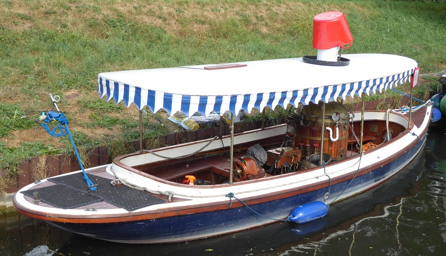
After a long time it was our turn into the lock.

With the paddle open it was effectively the sea filling the lock.

Then we were out and onto the tidal section. This is looking back at Salter's Lode Lock.

Denver Lock was soon reached: it's the leftmost part of the structure as you approach from Salter's Lode.

We slipped in beside the previous boat through Salter's Lode. The lockie there should have locked us out together.

We didn't really know where to go after leaving Denver Lock but, as we'd decided to go to Downham Market tomorrow, we turned left and tied up just before the lock we'll be going down.

It's all very confusing here, with waterways going in all direction. Some are navigable, some not. After tea we walked all around and tried to work out what was what.

It was a lovely hot evening with a great sunset. Here's one photo I took, of reflections under a red sky.

We met fellow BCF members - and bloggers - Mike and Christine on Alchemy just before we left Upwell this morning; we also gave Sally a short cruise to her house in Outwell.

Tomorrow, then, it's Downham Market and as near to King's Lynn as we can get on the Relief Channel.

Monday 23 July 2018

WEED!

We were getting on so well, the Twenty Foot River and us. We'd successfully negotiated one of the lowest bridges on the Middle Levels. Nothing disturbed us at our wild mooring last night. We easily got back into the centre channel this morning … and then came the weed.

There was no escaping it. The vile stuff spread from one bank to the other and clogged the prop verty quickly. In the worst areas I was down the weed hatch every few yards. Progress, as can be imagined, was almost non-existent.

This is our lunch 'mooring': stuck in the middle of the waterway.

There was so much weed coming out of the hatch that I knew I was actually pulling it off the bottom of the river.

I had to resort to punting with the cabin shaft to try to reach some clearer water - it's not easy punting a narrowboat.

Eventually the visits down the weed hatch became less frequent and we reached the junction with the Old River Nene. I had originally wanted to explore down to Benwick and Ramsey, but our experience with the weed rather put us off that idea. We turned left towards Upwell and Outwell instead. Funnily enough, we hadn't seen a single boat since joining the Twenty Foot nearly 24 hours earlier. Even the outer reaches of the BCN have more boats.

The route to Three Holes via Popham's Eau looked clear, wide and inviting, but we chickened out and turned left here too. The signs erected by the Middle Level Commissioners have writing that's far too small for me to read.

Before getting to Marmont Priory Lock we rang the number as instructed and left a message. No-one got back to us. At the lock itself we rang the bell, again as requested, and worked ourselves through in the normal manner. Nothing seemed to require the attentions of a lockie, who didn't materialise.

Here's something I hadn't come across before: a receptacle for tips for the lock keeper.

Needless to say, I didn't add to the coins in the tin.

Very soon we arrived in Upwell and found ourselves in our home county of Norfolk.

We tied up on the first public mooring, March Bank, I think it was called, but I then cycled up to the Church Bridge mooring and saw that we would fit there, so I moved the boat up.

We visited our friend Sally in Outwell after tea.