From a wedding with zero on the clock yesterday to one at the 40 years mark. Today we enjoyed another celebration, this time for Jan's former colleague Gill and her husband Peter on the occasion of their ruby wedding anniversary.
Peter is a pig farmer who tends to do well at agricultural shows. This year he - or, rather, one of his pigs - came first in class at the Royal Norfolk Show. At the celebratory luncheon what else could be on the menu but ham. And not just any old ham. This ham was from the very pig which won! It was about the tastiest I have ever, er, tasted.
In a word, champion.
Sunday, 31 July 2011
Top Thirty, 2011 Week 30
Here is the UK Waterways Site Ranking as it stood at 0945 on Sunday 31st July 2011. This is taken, with permission, from Tony Blews's UK Waterways Ranking Site.
1 Canal World Discussion Forums (=)
2 Jim Shead's Waterways Information (=)
3 Pennine Waterways (=)
4 CanalPlanAC (=)
5 JustCanals.com - Forums (=)
6 CanalCuttings.co.uk (=)
7 nb Waiouru (-)
8 Granny Buttons (-1)
9 Towpath Treks (-1)
10 Water Explorer (-1)
11 Waterway Routes (-1)
12 Jannock Website (-1)
13 boatshare (-1)
14 Canal Shop Company (=)
15 ExOwnerships (+2)
16 nb Epiphany (=)
17 UKCanals Network (-4)
18 Google Earth Canal Maps (-3)
19 nb Blue Moon (=)
20 NB Siskin (+1)
21 Takey Tezey (-1)
22 Trafalgar Marine Services (+2)
23 Narrowboat.co.uk (-5)
24 Narrowboat Caxton (+2)
25 Captain Ahab's Watery Tales (-3)
26 nb Lucky Duck (-3)
27 nb Piston Broke (+1)
28 Narrowboat Bones (-3)
29 Canal Photos (-)
30 Chertsey (-1)
The figures in parentheses denote the number of places moved since the previous chart;
(-) denotes new entry or re-entry into the top thirty;
(=) denotes no change.
Halfie is at number 39.
There are 143 entries altogether.
Saturday, 30 July 2011
To Outwell for a wedding
We drove to Outwell today for the wedding of our friends Sally and Stuart. Is there a church closer to a navigable waterway than St. Clement's? The church is inside a kink in the waterway.
The bride could have been transported to the church by boat, especially as their house is on the same waterway, which I believe is Well Creek.(or is it the River Nene?) But as the distance from house to church is only about 200 yards Sally chose to walk.
More walking: this time with husband Stuart down the nave. There was no reference to navigation in the service, sadly!
The paint on the village sign is peeling, but the picture is of interest to boaters. It depicts an aqueduct, which I take to be Mullicourt Aqueduct where Well Creek crosses the Middle Level Main Drain.
If I'd realised this before I got home, I'd have stopped to photograph the real thing.
The bride could have been transported to the church by boat, especially as their house is on the same waterway, which I believe is Well Creek.
More walking: this time with husband Stuart down the nave. There was no reference to navigation in the service, sadly!
The paint on the village sign is peeling, but the picture is of interest to boaters. It depicts an aqueduct, which I take to be Mullicourt Aqueduct where Well Creek crosses the Middle Level Main Drain.
If I'd realised this before I got home, I'd have stopped to photograph the real thing.
Friday, 29 July 2011
The lure(s) of the Wyrley and Essington
Back to our Easter trip around the BCN. On 7th April we were on the Wyrley and Essington Canal, heading for Horseley Fields Junction to join the Birmingham Canal (Wolverhampton Level). Just after the reflecting bridge a man hailed us from the towpath. He asked if we could retrieve for him some fishing lures which had got stuck in the fence on the offside. We obliged. I managed to extricate three lures which I threw over to the man.
Does he look like an angler to you?
Thursday, 28 July 2011
Will you take a Broseley?
"Will you take a Broseley?" was something which could, apparently, be heard in taverns all over the country in years gone by. The "Broseley" in question being a clay pipe made in the Broseley area of Shropshire. In the early days there were hundreds of individual pipe makers in the town; by the nineteenth century pipe making had become concentrated in three factories which supplied the needs of tobacco smoke inhalers everywhere. One of the factories, William Southorn and Co., has survived and is now a museum of the industry.
Remarkably, when the factory closed in the 1950s, everything was left undisturbed until it was opened as the museum in 1996. It's as if the workers could come back tomorrow and pick up where they left off. There's a mound of unprocessed clay in a corner of the yard; piles of empty cardboard boxes ready to be packed with new pipes; scrawled pencil notes on walls and bits of paper; the moulds and presses ready for action.
We stayed on a former farm in Broseley. The owner told us that there were two coal mines and a clay mine on his land, to which he still owns the mineral rights. The mines didn't survive beyond the 1940s, and locals used to tip their old fridges into the convenient holes in the ground! Something else tipped in large quantities down the bank were the reject pipes from a clay pipe factory. I was shown where to scrape the earth, and, in seconds, I'd uncovered a couple of pipe bowls and a dozen pieces of stem up to about four inches in length. These, unlike the occasional pieces which turn up in the garden, have never been smoked, and so the clay is white throughout.
Totally unconnected (as far as I know) is this house we spotted in Broseley High Street. The one in the middle with the red door. Is this the thinnest house in Britain? I think it was number 55.
Wednesday, 27 July 2011
Where the working boats went - Life and Times
At the bar of the Boat Inn - "Unspoilt by Progress" - by the Severn at Jackfield is a poster. It advertises a performance of "Where the Working Boats Went", being given as part of the Shrewsbury Folk Festival on Sunday 28th August 2011. It's being given by "Life and Times", which, as far as I can gather, is duo Graeme Meek and Barry Goodman. They promise "the story of Britain's industrial waterways in drama and song".
According to the Shrewsbury Folk Festival website all festival tickets are sold, but I don't know if that includes this event.
On the outside of the pub is a record of flood levels. It seems to have been flooded every year recently. The landlady told me that they don't bother sandbagging the doors as the water comes up through the floor anyway!
Tuesday, 26 July 2011
A stately pile
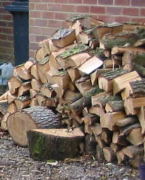
Just down the road from where we were staying in Broseley in Shropshire recently was the most amazing log store.
It rather puts our pile to shame!
Incidentally, I heard - was it this morning? - that now that log burners have become more popular as a result of the increased cost of gas and electricity, thefts of logs are increasing.
It rather puts our pile to shame!
Incidentally, I heard - was it this morning? - that now that log burners have become more popular as a result of the increased cost of gas and electricity, thefts of logs are increasing.
Monday, 25 July 2011
Which way up the Wrekin?
On our recent holiday in Shropshire we went for a walk up a nearby hill, The Wrekin. This sticks up from the surrounding undulating countryside and promises fabulous views over it.
Half way up we were intrigued to see this helpful sign.
The views were good, if a little hazy.
Welsh mountains loom on the horizon.
Top Thirty, 2011 Week 29
Here is the UK Waterways Site Ranking as it stood at 0815 on Sunday 24th July 2011. This is taken, with permission, from Tony Blews's UK Waterways Ranking Site.
1 Canal World Discussion Forums (=)
2 Jim Shead's Waterways Information (=)
3 Pennine Waterways (=)
4 CanalPlanAC (=)
5 JustCanals.com - Forums (=)
6 CanalCuttings.co.uk (=)
7 Granny Buttons (+1)
8 Towpath Treks (-1)
9 Water Explorer (=)
10 Waterway Routes (+1)
11 Jannock Website (-1)
12 boatshare (=)
13 UKCanals Network (+1)
14 Canal Shop Company (-1)
15 Google Earth Canal Maps (+3)
16 nb Epiphany (=)
17 ExOwnerships (-2)
18 Narrowboat.co.uk (-1)
19 nb Blue Moon (+2)
20 Takey Tezey (=)
21 NB Siskin (+7)
22 Captain Ahab's Watery Tales (+1)
23 nb Lucky Duck (-4)
24 Trafalgar Marine Services (-2)
25 Narrowboat Bones (-1)
26 Narrowboat Caxton (-1)
27 Derwent6 (-1)
28 nb Piston Broke (-1)
29 Chertsey (+1)
30 NB Windsong (-)
The figures in parentheses denote the number of places moved since the previous chart;
(-) denotes new entry or re-entry into the top thirty;
(=) denotes no change.
Halfie is at number 35.
There are 145 entries altogether.
Saturday, 23 July 2011
Hay Inclined Plane was nearly Hay Boat Lift
It is said that the original scheme to connect the upper and lower levels of the Shropshire Canal at Blists Hill/Coalport was to build a boat lift to overcome the 207 feet difference in height. To this end William Reynolds, a local ironmaster, started to tunnel horizontally into the side of the hill in 1786. After 300 yards the workers hit a spring of bitumen, and work on the tunnel stopped while this valuable natural commodity was tapped, put into barrels and sold.
According to the Ironbridge Gorge Museums website the bitumen was boiled in cauldrons at the entrance to the tunnel to convert it into pitch for preserving timber; some was processed for use in lamps and as a varnish. At first they were collecting 4,500 gallons of bitumen a week. This slowed to 1,000 gallons a week, gradually dimishing over fifty years until the extraction stopped.
Now known as the Tar Tunnel, we donned our hard hats and walked at a stoop to the gate a hundred yards in. Bitumen still oozes through the brick walls and collects in pools in openings off the tunnel, looking like black water. (No photo, sorry!)
The tunnel is said to extend 1100 yards under Blists Hill, probably connecting up with the coal mine shafts. A plateway or railway runs the length of the bit we had access to, and there are some wagons near the entrance.
The bitumen was reckoned to be far more vauable than the boat lift, and so the inclined plane was built instead.
Friday, 22 July 2011
Hay Inclined Plane
When we visited Blists Hill the first thing we did was to find the Shropshire Canal and walk along the towpath to the Hay Inclined Plane. Just in front of us as we walked along was a man in Victorian dress, who turned out to be the "guide" for those who found their way to the plane and wanted to find out more about it. After a promising start the canal quickly turned into a weedy swamp. Our guide explained that the water level had been lowered so as to minimise problems with leakage. I suppose if there's no water it can't leak anywhere!
The inclined plane was used to raise tub boats such as the one below - about 20 feet by six feet with a capacity of about five tons - from a short (half-mile) section of canal at Coalport by the river Severn to the level of the Shropshire Canal about 200 feet higher.
At the upper level boats would be floated onto wheeled cradles which were then hauled up a short slope on rails, before being let down in a controlled descent of the plane to the canal at the bottom, where they would float off. The purpose of the short slope in the "wrong" direction at the top was to keep the water in the upper canal.
Looking in the opposite direction, down the incline, many of the original rails have been replaced with more modern ones so as to give an impression of what it looked like when working.
At the bottom the rails just disappear into the water. The house by the steps is now a lovely tea room.
The traffic was mainly loaded tub boats, carrying cast iron, coal and clay, going downhill, pulling up empty tub boats as they went. A steam engine was built in the engine house (below) to assist in the operation, replacing a horse gin.
During the life of the inclined plane a railway was built passing underneath (this is now the Silkin Way). Now a bump (which my photos don't show) in the plane reveals how the strong foundations for the bridge have held up the track above, while the rest has subsided a little. The sides of the gorge are, we were told, constantly on the move.
The canal at Coalport with a bottle kiln from the china factory. Goods were transhipped to barges or trows to be taken down the Severn.
Next time, how the Hay Inclined Plane shouldn't really have been built.
edited to add: Much useful information about the Shropshire Canal, its inclines and tub boats can be found here.
Thursday, 21 July 2011
Cast in iron, errors and all
One of the museums in Ironbridge Gorge is Blists Hill Victorian Town. This is a mixture of original industrial remains - blast furnaces, mine shafts and a brick and tile works - and recreated shops and businesses from the nineteenth century. It feels rather like the Black Country Living Museum, and I loved it. So much so that we went back three days after our first visit.
We made sure we were in the New Inn for the music hall singing. This was excellent: two men in period clothes started a banter in loud voices, then one sat at the piano and started playing. Both men sang lustily and well. There were moments, especially when the characters held my eye, when I had a very strong feeling of being in the film Westworld. Spooky!
But to the real excitement. On Sunday we saw moulds being created from "green sand". This was actually black, after starting off yellow. It goes black after coming into contact with the molten iron and associated gases. The sand has about four per cent clay added, and is slightly dampened. This helps it to mould to the shape of the pattern, and to keep the shape when the pattern is removed. After being energetically tamped down the outer casing, which goes round just the sides, is removed, leaving the sand in a cuboid form - sitting on a small wooden pallet - with nothing but air where the iron is to go.
On Wednesday the cupula furnace was charged with coke, limestone and scrap iron. Once it's given a little heat the coke burns fiercely in the air which is blown in, and the furnace doesn't need any external heat. We missed that, but saw the next stages of the process.
The resultant molten iron was allowed to flow down a chute into a bucket.
This was then manhandled over the moulds and the iron poured in to the filling hole.
At one point in the process molten slag was tapped off, being allowed to flow onto the ground outside. This was accompanied by a spectacular shower of sparks.
After 30 minutes to an hour the pallets were picked up and thrown onto the floor, causing the sand to break up around the precious solid inside.
And here is one finished article. Something for Ruth and Mark's sixth wedding anniversary!
Despite all the skill invlolved, sometimes mistakes can creep in.
Oops!
I wonder which will last longer: the cast iron sign or my photo of it on the internet?
Wednesday, 20 July 2011
Blists Hill blast furnaces
Just a quick post tonight as it's late. These are the remains of three blast furnaces at Blists Hill in Ironbridge Gorge in Shropshire. They were built in the 1830s and 1840s and operated until 1912. They took some of their raw materials - iron ore, coal or coke and limestone - from tub boats on the Shropshire Canal which runs just behind and above the furnaces, and the pig iron they produced was carried away by canal too.
Some coke making was done on the site, and minerals were also mined very near by.
Tuesday, 19 July 2011
Ironbridge Gorge
I touched on the Industrial Revolution yesterday with Arkwright's cotton mills at Cromford. Our next stop was Ironbridge, where the Revolution really hotted up.
Before talking about Blists Hill, though, a couple of photos of the main attraction - the iconic iron bridge itself.
At Blists Hill there's a short section of the Shropshire Canal still in water. We walked along the towpath to the Hay Incline, of which more later.
On the approach to the place where we're staying, in Broseley, we came across a snake!
Unfortunately it was dead and seemed to have been run over. Grass snake? (I'll look at the book when I get home!)
Monday, 18 July 2011
Cromford Mill
Last week, while still in Derbyshire, we visited Cromford Mill, a world heritage site preserving what remains of Richard Arkwright's pioneering use of water power in industry. Arkwright invented the water frame, a simple-to-operate device powered by a water wheel to spin cotton. His mill at Cromford was the world's first successful cotton spinning factory, and the first building put up specifically to house machinery.
When Arkwright took over the site in 1771 this bridge carried the main road. When he built his mills they blocked the road, so he provided an alternative route by cutting into a nearby rock outcrop. The bridge crosses Bonsall Brook, one of the water sources; the other being Cromford Sough which gave a reasonably constant supply of water from Wirksworth lead mines.
In 1793 the Cromford Canal was built. This would have been a considerable help to get the factory's output distributed. The canal terminates in two arms; each of the two wharf buildings has an overhanging loading bay.
Sunday, 17 July 2011
Making Hay while the sun shone
Parsley Hay, that is. Parsley Hay is a tiny place in Derbyshire where the former railway line from Ashbourne to Buxton joins the former Cromford and High Peak Railway. There's also a cycle hire place and a café. And loos.
This view through a road bridge under the C&HPR shows the lovely countryside round here.
I mentioned embankments yesterday: here are two striking examples at Minninglow.
It's almost as if someone has only just come along and filled the depression in the ground with stones. Perhaps canal embankments looked like this until the trees grew up alongside to strengthen the banks. Railways, of course, weren't concerned with water retention, and trees presumably found it hard to grow in dry stone.
One byproduct of having walls, fences or hedges along the railway line - to keep livestock out - is that it's a haven of wild flowers, ungrazed by cattle or sheep.
This is a five-spot Burnet moth, as were were informed by another couple walking the route.
Subscribe to:
Posts (Atom)